Chesapeake Bay Maps
Click on one of the maps below for a larger view.
The maps below are to be used as a reference only and not for navigation.
Lower Bay

Mid Bay

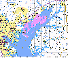
Upper Bay
Chesapeake Bay Charts
Below are 2 Chesapeake Bay chart images. One of the northern bay and one of the southern bay. These are large images and may take up to 1 minute to download. Remember, these are not to be used for navigation.
Northern Bay Chart
Southern Bay Chart
Download Hint: These charts open in a new window, to return to this page simply close the new window. If the charts look small after they download hold you mouse pointer over the lower right corner and wait for the “image icon” to pop up then click on it to expand the images.
Maryland Destinations
Below are links to interactive chart images provided by the MapTech Mapserver web site. The charts below are to be used as a reference only and not for navigation. Additional chart images can be obtained by visiting the MapTechweb site.
- Havre de Grace
- Gunpowder River
- Hart Miller Island
- Baltimore’s Inner Harbor
- Magothy River
- Annapolis Harbor
- St. Michaels
- Chesapeake Beach
- Solomons Island
- C&D Canal
- Middle River
- Fairlee Creek
- Approach To Baltimore Harbor
- Rock Hall
- Chestertown
- Kent Island Narrows
- Cambridge
- Point Lookout
About Us | Advertise | Link Exchange | Site Credits | Sponsors & Partners | Privacy Policy | Terms & Conditions